Port Alfred Airport
Appearance
Port Alfred Airport | |||||||||||
|---|---|---|---|---|---|---|---|---|---|---|---|
| Summary | |||||||||||
| Airport type | Public | ||||||||||
| Serves | Port Alfred, Eastern Cape, South Africa | ||||||||||
| Elevation AMSL | 272 ft / 83 m | ||||||||||
| Coordinates | 33°33′15″S 26°52′47″E / 33.55417°S 26.87972°E | ||||||||||
| Map | |||||||||||
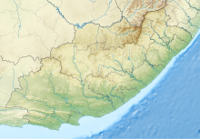
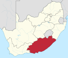
Location of airport in Eastern Cape province | |||||||||||
 | |||||||||||
| Runways | |||||||||||
| |||||||||||
Source:[1] | |||||||||||
Port Alfred Airport (IATA: AFD[2], ICAO: FAPA) is an airport in the seaside town of Port Alfred, located in the Eastern Cape province on the southern coast of South Africa.
Facilities
[edit]The airport resides at an elevation of 272 feet (83 m) above mean sea level. It has three runways, the longest of which is 1,828 metres (5,997 ft).[1]
References
[edit]- ^ a b "Airport information for Port Alfred, South Africa (FAPA / AFD)". Great Circle Mapper. Retrieved 17 June 2013.
- ^ "IATA Airport Code Search (AFD: Port Alfred)". International Air Transport Association. Retrieved 17 June 2013.


